Showing posts with label Level: Strenous Walk. Show all posts

19 February 2012

Back Table: Hunt for the Red Disa


Date: 10 February 2011

Location: Table Mountain, from Kirstenbosch

Walkers: Marie, Ellen & Helen

*** Route plotted here ***

Previous walk hereabouts here.

I met up with Marie and her friend Ellen (visiting Cape Town for the first time) for a walk up the mountain to look for Disa uniflora, the Pride of Table Mountain, our famous red disa! From the nursery entrance to Kirstenbosch we got a good look at our proposed route up Skeleton Gorge, to the right of Castle Rocks. It looked a long way up but it we had lots of time and perfect walking weather (which this time of year means cool temperatures and a breeze). We followed the jeep track and then the steps up the slope and into the forest, crossing the contour path and onwards up, up, up.


The walk got more interesting once we reached the ladders. I like climbing up wooden ladders - well, nice sturdy ones like these.


Beyond there was quite a lot of scrambling up and over rocks and zig-zagging up the steep slope. We took it slow, stopping often for short rests. The morning sun was streaming down through the leaves. It was good to be on the mountain!


Near the top of the gorge it was very lush and ferny.


On one bend, where we should have seen our first red disa (and where last year I saw a bud) we saw a broken-off stalk. Someone had selfishly picked the flower! Disappointing and very annoying.


A little bit further on we emerged out of the forest.


And close by we saw our first clump of disas!


It was the first time that Ellen or I had seen these orchids and we were both blown away by their beauty. They're larger than I was expecting (size of a child's hand) and the most vibrant crimson colour and striking form. Truly magnificent flowers, and totally worth the effort to see them in situ.


We made our way to the intersection and turned right onto Smut's Track. After a quick stop for refreshments we continued on this path, climbing steadily. There was a nippy wind blowing on top of the mountain so I put on my fleece vest and wind-breaker. Glad I'd brought them!


Flowers spotted up here: quite a few Agapanthus africanus.


Delicate Erica lutea, light yellow in colour.


Pretty Gladiolus monticola
, nodding in the breeze.


We caught a delicious scent on the air and zeroed in on this small bush. The flower looked to me like china flower, but I didn't expect to see it flowering this time of year, and I didn't know the plant was so fragrant - rather like buchu... citrus and herb... deeply aromatic. Yum! I am pretty sure it is indeed china flower, most likely Adenandra uniflora. A lovely plant... I wonder if it would grow in my garden?
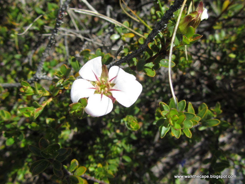


After a while we crossed a stream. We stopped to do some exploring hereabouts and found more red disas. An abundance!


A little way further the path started climbing up Fernwood Buttress. About half-way up, between the rocks, we turned onto the aqueduct, heading left.


This route would take us along into the valley we could see ahead. It was easy walking along the aqueduct. This stone canal was built in the 1800s; it channels water down to the dams further on.


On these damp slopes: plenty of interesting moss and lichen.


And the occasional Tritoniopsis parviflora, almost over.


And below, hiding in the undergrowth, plenty more red disas.


Just before we crossed the bridge we spotted a tall shrub, grey foliage and purple leaves. A new one for me: Amphithalea imbricata. So attractive!


Marie's eagle eyes spotted a little bokkie perched in a boulder high on the slope ahead. A klipspringer! She seemed very calm, watching us as we walked slowly past. Lucky us to get to see her!


The path we were on took us down through a most spectacular gorge, quiet and lush. This was an entirely new part of the mountain for me - it felt like real wilderness. I loved it!


Looking back up the gorge as we neared the end of the climb down.


Below: calm pools in the stream, the water the colour of rooibos tea, and more red disas. Idyllic spot to have a swim on a warm day.


After a while we reached the dams, heading first towards the waterworks museum building and then walking swiftly along the dam wall. Brrr, a cold wind was blowing strongly here.


We turned onto the path leading to Nursery Valley. It's always nice to walk down through the unexpected grove of trees that grow here.


My favourite picnic spot was already taken so we pressed on and stopped for lunch at the top of Nursery Ravine instead. Looking at the view and contemplating the descent as we ate.


It was a long slog down, legs weary and wobbly. Step, step, step.


Mid-way down: a final floral treat... a king protea. How lucky to see one in flower this time of year!


More pics from Marie and from Ellen. Thanks ladies - it was a super walk!
.

21 March 2011

The Whale Trail: Day Two

Date: 10 March 2011

Location: De Hoop Nature Reserve, in the Overberg

Walkers: Ian, John, Marianne, Rainer, Madeleine, Rob, Rooken, Kati, Michele & Helen

*** Route plotted here ***

DAY TWO: From CUPIDOSKRAAL to NOETSIE

More info about the trail here. Map (pdf) here. See also: Day One.

After retiring early the night before, our group stirred around dawn. We set off at 7am for our second day of walking. Like the day before we had around 15km to cover. It was a cool grey morning, with low misty cloud.


Our path up Hamerkop was a pleasant steady climb, and it wasn't long til we were in the mist.


And soon after that the mist turned to drizzle. Michele and I whipped out our rain ponchos. Although they looked rather ridiculous they worked really well: big enough to cover our packs as well as ourselves, they kept us perfectly dry. We both had proper waterproof jackets with us as well but these would have been too hot. Despite the precipitation and the early hour, the day was warm, still and very humid.


Close to the top of the hill we were excited to find several more Gladiolus cardinalis, like the one spotted the day before. They really are the most gorgeous flowers aren't they?


Also spotted: yellow Bobartia indica and another gladiolus in a pale pink.


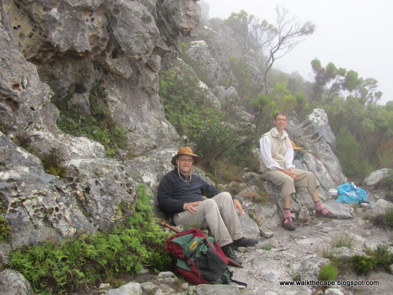
In the gloom we made out the beacon marking the highest point (455m). Fortunately there was a break in the rain, and Ian and John were waiting for us, so we made this our stop for tea: a hot cuppa enjoyed amongst the rocks and ferny undergrowth.


As we continued onward there was still so much cloud around that there were no views to see. Instead we focussed on what was directly in front of us. This included: many anthills, even more spiderwebs covered in water droplets, and interesting mosses and lichens on the rocks.


Unfortunately the rain began to fall again, so we donned our rain gear once more, put our heads down and trudged on in the wet for a good few kilometres. The rain seemed to be steady and set-in. It wasn't long before my shoes were very wet and squelchy.


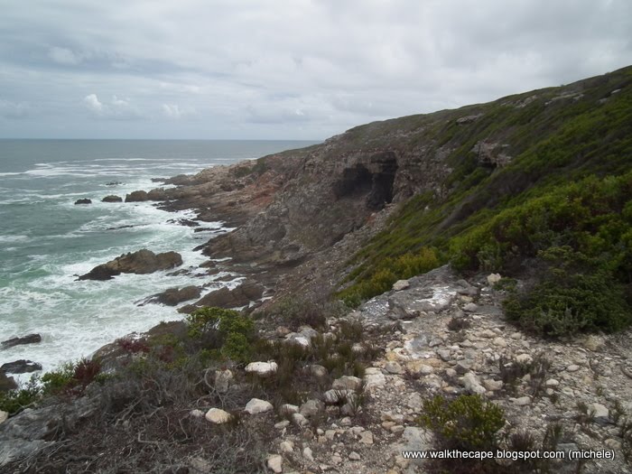
We reached the end of the escarpment and got a view down to the coastline. Our destination was the overnight hut Noetsie, which we knew was in the little bay we could see in the distance. It looked a long way away. So we continued on, in the rain, taking care to walk carefully as the path began to descend steeply.


About half-way down the hill the rain eased up, then stopped, and it brightened up. Hooray!


The flying ants came out and we watched an excited sugarbird feasting on the insects.


The other hikers in our group had walked on ahead, so Michele and I were, once again, bringing up the rear. We could see Ian and John up ahead, stopped at the spot where the path crossed the road, so hurried along the path to join them.


Here we paused for a picnic lunch, spreading out our wet rain ponchos and other gear to dry. I also took my shoes and socks off. Walking in them wet for so long has started to give me blisters and my feet were a bit sore. It was nice to get the shoes off and wiggle my toes.


After a good meal and a nice rest we bundled up our stuff and continued on the path. The sign indicated we had another 4km to go to reach Noetsie.


According to the info on our map we were walking into ecotone, a mixed-vegetation area where the sandstone of the hills meets the limestone of the coast. There were also a lot of alien plants which are apparently being eradicated. We could see piles of cleared aliens, but this is obviously an ongoing problem... much more hacking needed.


This low-land area was also home to many reeds and restios. It probably gets very boggy in the wet season. There were a few flowers to be seen as well, including staavia and struthiola. I'm not sure what the sweet little five-petalled flower was, but there were a lot of them too.


Also spotted: some very large tok tokkies (edit: I mean dung beetles).


As the path climbed slightly I glanced back at the hills we'd just left. The mountain part of the hike was over. Onwards to the coast!


We found the terrain here very interesting. It was very rocky, but the rocks had weathered so that they were holey, like swiss cheese. Plants were growing in the holes... they looked like miniature gardens.


Some of the plants here include buchu, metalasia, restio and erica.


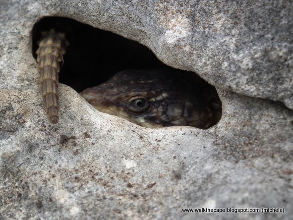
The holes in the rocks provided perfect hidey-holes for lizards too.


Although some lizards were so perfectly camouflaged on the rocks they hardly needed to hide.


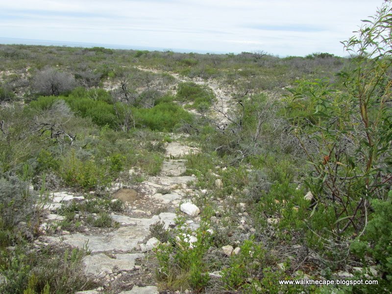
A fire must have burnt this area a year or so back - there were lots of dead shrubs, protea or leucadendrons I think. It was a bit bleak.


Not many flowers about, although we did spot one or two chironia.


The path seemed to go on and on. We were very grateful that it was still overcast; walking through this area in the blazing sun would have been hard going as there was no shade at all. We plodded on, down a dip and onto another hillside. We got a quick glimpse of the bay, but still had more distance to cover before we got there.


Although we didn't see any baboons we knew they were in the vicinity as we passed a lot of baboon poo. Ew, stinky.


At last, Noetsie camp was in our sights.


As we got to the cliff-face we saw, to our right, a cave where an archaeological dig appeared to be progress. We found out later that some of the other hikers in our group had met the archaeologists when they reached Noetsie. The team had been on site for six weeks but has packed up their camp and left that day.


To get to the huts we followed the path down the steep cliff and across the small rocky beach.


Hello Noetsie! I was very happy to get to camp.


There were two thatched buildings, one kitchen/bathroom, and the other a dormitory for eight.


There were also a couple of wooden cabins, each sleeping two. Like all the huts, Noetsie was well-stocked with kitchen utensils and cutlery and crockery for twelve. The lights were solar-powered, and there were gas geysers for hot water and a gas cooker. No electricity and no fridges.


Noetsie also had a lovely boma, almost on the rocks. After rests and showers we gathered there around the fire. It was good to relax after a hard day's walk and listen to the crash of the waves.


We were watched by a baboon on the cliff behind the huts. The archaeologists said one of their tents had been totally trashed by baboons, so we we kept a close watch on this fellow but he didn't come down.


John showed us the collection of toothbrushes he'd collected on the little beach. After being in pristine nature for two days it was bit of shock to see how much rubbish there was there, all washed up by the sea. He'd picked up only toothbrushes but there was an plenty of other litter, especially plastic bottles and fishing paraphernalia.


We compared walking experiences, and were all glad that the rain seemed to be over. We'd completed two of the five days, but over half the distance (30km of the total 55km). Tomorrow we had a shorter walk, along the coast.


We sipped our drinks and watched the day fade. Once dark we enjoyed Madeleine's yummy risotto for supper, and then crashed into bed.


Next up: Day Three.
.