25 May 2009

Signal Hill

Date: 23 May 2009

Location: Signal Hill

Walkers: Michele, Dorothy, Helen

*** Route plotted here ****

We set off from the parking area area on Signal Hill Road.


(Photo by Michele)

Instead of taking the main route to the left up Lions Head, we took a path to the right. This ran parallel to the road, towards Signal Hill.


(Photos by Michele) (Photos by Helen)

The City Bowl, Devil's Peak and Table Bay were on our right.


(Photo by Michele)

Behind us was Table Mountain, looking serene on this cloudy grey day.

(Photo by Michele)

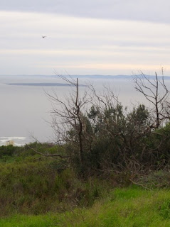
After a way we got a great view back to Lion's Head (we passed the turn-off that would take us up the peak via the back route). We could also see down to Robben Island in the Atlantic.

(Photos by Michele)

Next came the kramat on the ridge of the hill - we had a quick peak inside.


(Photo by Michele) (Photos by Helen)

From here we continued our walk along the spine of the hill. We were on the Atlantic side now, and could see down to Fresnaye, Sea Point and Mouille Point, with the West Coast beyond.


(Photos by Michele)

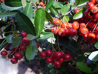
Along the path we saw lots of Oxalis as well a strange prickly strawberry-like plant that I haven't been able to identify. Can any of you help with its name?


(Photos by Michele)

We came to the main Signal Hill parking and picnic area. Vendors were selling paintings, and ice-cream cones. We sat at the observation deck and ate our naartjies, and gazing at the view.


(Photos by Michele) (Photos by Helen)

Then we meandered back along the same route.


(Photos by Helen)
.

20 May 2009

Table Mountain Contour

Date: 19 May 2009

Location: Tafelberg Road, Table Mountain

Walkers: Dorothy and Helen

**** Route plotted here ****

This was my first walk in ten days - I've been sick, and Cape Town has been having its first winter storms: lots and lots of rain! We knew that there would be a lot of water on the mountain when we saw the stream at Platteklip gushing down into the pond.

We headed up the familiar route, hopping over the water where necessary.


At the intersection with the contour path we turned right, signposted to the cableway's lower station, and followed the contour across the face of Table Mountain. The path runs at the base of the rock face.


It was easy walking along the contour, towards the setting sun. Behind us a wisp of cloud appeared in the Saddle.


At one point we walked under a waterfall!


The sun set quickly, and we had to hurry.


We had a quick peak round the corner towards Camps Bay, before swiftly making our way down the steps at Kloof Corner to our waiting car.


(All photos by Helen)
.

17 May 2009

Fernwood Track in Newlands Forest

Date: 9 May 2009

Location: Newlands Forest

Walkers: Jenny, Helen, Claudia, Richard and Daisy

**** Route plotted here ****

We set off along our usual route, heading south (direction Kirstenbosch) .


Instead of turning up the first forestry road we went a little further on and up the second road. This zig-zagged gently up the slope - very pleasant walking with the bright midday sun filtering through the trees.


After the clearing we proceeded up Fernwood Track, though thick indigenous forest. Some of this route is along wooden boardwalk, and over many mossy rocks.


We then met the contour path, turned left and walked on to the edge of Kirstenbosch, and then headed down again, through Loeriesbos. A section of this way down was along another road; from here we could see across to Wynberg Hill and Constantiaberg in the distance. We paused for a bit to watch three birds of prey soaring above us.


Taking a path left back towards the start of our walk, we came across the tumbled-down ruins of a woodcutter's house.


From here it was just a short walk through the forest, back to the start.


It was good see autumn flora and foliage along the way.


Other walks in Newlands Forest are described here and here.

(All photos by Helen)
.