Date: 25 April 2010
Location: Helderberg Nature Reserve
Walkers: Aafke, Leighan, Dorothy & Helen
*** Route plotted here ***
The Helderberg Nature Reserve starts at the edge of the town of Somerset West and extends up the slopes of the Helderberg Mountains. We arrived mid-morning and spent a few moments at the map at the start of the walking trails choosing our route.

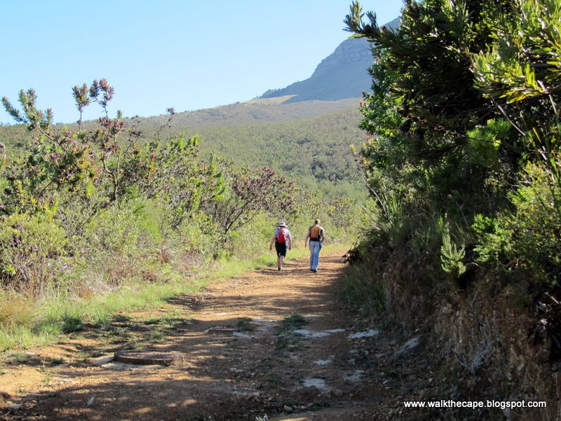
We decided to head up on the 'yellow route' path and then follow the 'black route' that loops across the hillside. This looked like about two hours walk at our usual relaxed pace. The first section was along a path in the forest. Before long we joined the jeep track. Now out in the open, we got fabulous views of the surrounding ring of mountains.


There was a fire here a year or so back, and the fynbos is still recovering.

Further up the hill we passed through a gate. We walked left and up along the track, following the wooden route markers.


This pretty flower was growing on the wayside, a Chironia perhaps?

There was also a lot of Oxalis growing in the shady spots, in white and every shade of pink and soft purple. Such delicate little flowers.


The fynbos was varied and vigorous.

And the views were lovely! To our right we could see across to farmland with Sir Lowry's Pass in the distance. Behind us we could see down to Strand, Gordon's Bay and the ocean.


A route marker showed us that we needed to turn off the main track and follow a narrow path to the right - the 'black route'.


This path was on the contour and wound through gorgeous vegetation.


My favourite section was a patch of Brunia noduliflora.


These fluffy white pompoms are irresistible!

At one point we got a chance to look down on the part of the reserve we'd walked through: we could see the small dam near the entrance and the jeep track snaking up the hillside.

The 'black route' contour ended on another jeep track where we took a short breather to admire the view, before heading back down the hill.


A Cape Sugarbird was whistling happily in a nearby bush.

We noticed a lot of pink on the way down... pink erica, orangey-pink new growth on the protea plants and pink proteas in bud and in flower.


We joined a wooden board-walk for a way, then followed paths to the dam, a most restful spot. Slowly we meandered back down to where we'd started.


Here we inspected the flowering specimens and read the noticeboard - info about the reserve and the various activities that take place there. One can also read about events in the reserve on their website's calender. Lastly we took a table at the restaurant for a cup of tea and a bite to eat. Great day!


(Photos by Helen)
.