Showing posts with label Swellendam. Show all posts

28 February 2012

Swellendam Dog Walk on the Hill


Date: 13 February 2012

Location:
Swellendam

Walkers: Helen, John and Ian, with the dogs

For this evening's dog walk we took a short drive and strolled out onto a hillside overlooking the Marloth nature reserve. Such lovely mountains!


Towards the end of the walk the sun peaked out from behind the clouds and washed the hills in golden light.


.

Swellendam: Dog Walk on Farm Road

Date: 12 February 2012

Location:
Swellendam

Walkers: John, Ian and Helen, with the dogs

My brother lives on the edge of town in Swellendam. It is very nice to be able to take a stroll from the house along the various country roads in the area. This evening we turned towards the farm and said hello to the cows.


.

27 February 2012

Tradouw Pass for a Swim


Date: 12 February 2012

Location: on the Tradouw Pass, not far from Swellendam

Walkers/Swimmers: Helen, Ian & John

It was a warm and sunny afternoon and we took a drive from Swellendam, through the little village of Suurbraak and along the Tradouw Pass direction Barrydale. The plan was to find a suitable spot to have a little picnic and a swim in the river.


This route is a very pleasant scenic drive and we stopped a couple of times to admire the view. The road was built by Thomas Bain in the 1870s.


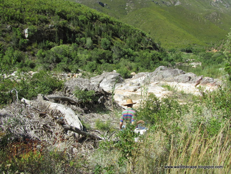
After Stone Haven (a private nature reserve) we found a place where the road passed quite close to the river, and we decided it would be a good spot to do some exploring. It was just a short stroll to the water. We looked up and down river to find the best swimming hole.


Gorgeous mountains all around us!


The rocks were very pretty too - smooth and shiny, with pastel streaks.


There was a lot of this wild flower around. A type of statis perhaps?


It wasn't long 'til we located a perfect place for a dip.


Easy access into a deep pool. Hugely refreshing!


Afterwards we sat on the rocks, nibbling our snacks, watching the clouds pass by and enjoying being outside on such a perfect afternoon.


.

Swellendam Dams: After the Fire


Date:
11 February 2012

Location: outside Swellendam

Walkers: Helen and Ian, with the little dogs

Previous walk in this location here and here.

In Swellendam for a long weekend, visiting family. We went up to the dams for a short walk, around the top dam, to give the dogs some exercise and for me to get a closer look at the damage done by the fire that tore through here two weeks previously. I'm not sure how or where the fire started but the area that burnt is huge: from the top of the tallest peaks right down to the valleys and all around dams, through indigenous forest and plantation, and alarmingly close to my brother's home on the edge of the town.


Last time I was here the foresters were clearing some the pines, and it was interesting to see how the stumps and roots had burnt away entirely leaving 'burrows' in the earth. It looked very unstable. We stuck to the road for safely.


I know fires are meant to be part of the cycle of life and that these hillsides will recover in time, but I found this landscape made me feel so sad. It was deadly quiet and still, no birds or wildlife around, and the burnt smell lingering. It was all very depressingly grey, and it didn't help that it was a very gloomy day.


However there were already signs that the recovery process had begun. The palmiet along the edges of the dam was shooting.


Some grass was growing in the damper areas.


One or two trees had shoots.


Bracken was unfurling.


And reeds were emerging.


I was excited to see one spot of colour! A Haemanthus bud. Paintbrush lily.


.

13 August 2010

Swellendam: Dams and Beyond

Date: 10 August 2010

Location: outside Swellendam

Walkers: Ian and Helen

Previous walk in this location here.

After three days of rain... yay, sunshine again!


Swellendam has three municipal dams in the valley below Marloth. We found a place to leave the car near the middle dam, and strolled along to the dam wall. We could see that the hillside opposite was being cleared, and that the water level in this dam was on the low side.


It appeared that all the water was being channelled to the lowest dam.


After crossing the dam wall we walked up the forestry road past the area being cleared. Although most of the big logs have been moved there was still a lot of undergrowth and offcuts scattered around. Kind of messy and a bit depressing.


The end of the dam was looking particularly sad and scruffy.


Although the wetlands beyond looked like they were doing okay!


We climbed up a little until we reached the canal. Water from the Hermitage valley is channelled around the hillside to feed the dams. The canal that feeds the top dam was blocked off so the water was gushing along the alternative route... down the hill. Gurgle-gurgle!


We followed the path alongside the dry canal towards the top dam.


This top dam was empty. My brother says some dredging project is being undertaken, although there were was no-one working there today.


Beyond the dams the forestry road narrowed to a grassy path. We continued up the valley, past a patch of attractive indigenous forest.


There were quite a few pretty pink Cape Sweetpea trees growing here. Podalyria calyprata.


We also saw plenty of pink Oxalis.
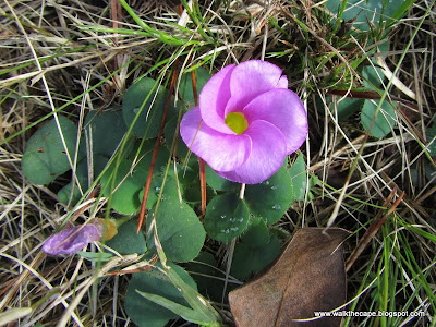


And a lot of the foliage was showing new growth.


The walking was very easy... a gentle uphill stroll amongst the trees.


We'd passed a route marker for the Wolfkloof Hut (last overnight stop of the Swellendam Trail). Although the hut was still several km's away, we realised by the proximity of other huts and cabins that we were now within the Marloth Reserve. The mountain peaks were close by too!


Yes, we were now directly below Doktorsbos.


We could see across to One O'Clock peak on the other side of the Hermitage Valley. Ian and I are both very curious about that almost-hidden valley. One can only get tantalising glimpses of it, but unfortunately it's private land so one can't explore. Although we would so love to!
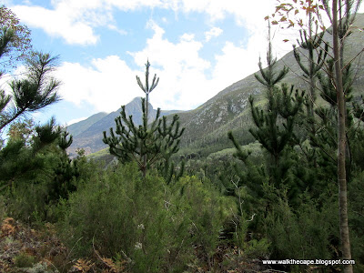


We could also look down the hill and back down to the middle dam where we'd started walking. Usually the plantation would hide the dam from view, but now there is just a bare hillside.


After a stop for snacks we made our way back down the same way, until we got to the dams where we took an alternative path that took us down with the dams on our right. From here we got a good view of the earth-moving project going on in the top dam.


We walked along the road for a while and then beside the canal channelling the water down to the lowest dam.


The ubiquitous white erica was growing hereabouts too.


So delicate, with teeny-tiny white flowers.


Wasn't long til we were back at the middle dam. What a refreshing walk!


.