 Date: 29 November 2009
Location: Newlands Forest
Walkers: Dorothy, Helen & Michele
Archive of all walks in Newlands Forest here.
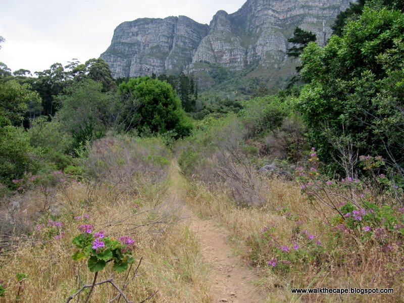
We met up for a late afternoon amble through the trees of Newlands Forest.

Just to the right of the main notice board we saw a sign for the Littlewort Trail, so we decided to try this route. Here, at the start, we noticed route marker "A", a little further on "B", so presumed we needed to follow these short log pillars to complete the trail.


Although there's no map or information available here at Newlands, I've since learnt* that this is a self-guided educational trail and one can get hold of a brochure that describes the route. The route markers indicate points of interest on the way (geology, vegetation, etc).


The path led us through various different forest environments. It was a very easy and pleasant stroll, even if we weren't sure to what we should be paying attention!

Somehow we lost our way after marker "L" - I think by taking a right instead of a left at a T-junction. We found ourselves on one of the main roads through the pines, and decided to follow this instead, a route with which we're very familiar. We meandered back down to the start.


In the pine forest we were very intrigued by a bush bearing red flowers and small green berries, which ripen to black, in little bunches hidden under the leaves. So eye-catching! Any idea what this might be?

(Photos by Helen)
* My googling of "Littlewort Trail" led me to this article. I was impressed to read that the blogger went to the trouble to track down the brochure. Wouldn't it be nice if the authorities made it, and a map, available online?
.


2 comments:
Hi Helen
At L, you should have kept left, between the 'octopus trees' (wild olives, I think) towards the Newlands Stream. Just as you reach the Stone Bridge, there's a marker M. The marker N is on the far side of the two benches at the Stone Bridge.
Keep going straight up along the northern edge of the stream, you'll pass O (where a river of rocks comes tumbling down on the right), and keep going up until you reach another T-junction at P.
If you turn left, you cross a boardwalk section, and the next marker you see will be 'X', which is near that field of huge white tumbled boulders.
If you turn right, the path will lead you past Q and to the edge of the pine forest. You'll see a marker slightly to the left of the path - this is R. Follow the path up the hill, until it becomes narrow. When you reach another stream, you'll see the marker for S.
Cross the stream, and you'll see T. And then you follow that little path past U and V, heading back towards the main Newlands stream. Somewhere here, you'll see 'W' - I don't know if there's a marker anymore, or if it's just a white painted W on a boulder near the stream.
Follow the path downhill, staying on the northern side of the stream, until you reach 'X' at the field of boulders.
Unfortunately, there ain't no Y or Z! So from there you need to make your own way back to the start.
Good luck!! :-)
You are a STAR! Thank you so much for the information, Reggie. I look forward to completing the rest of the trail.
Post a Comment