 Date: 23 May 2009
Location: Signal Hill
Walkers: Michele, Dorothy, Helen
*** Route plotted here ****
We set off from the parking area area on Signal Hill Road.

(Photo by Michele)
Instead of taking the main route to the left up Lions Head, we took a path to the right. This ran parallel to the road, towards Signal Hill.


(Photos by Michele) (Photos by Helen)
The City Bowl, Devil's Peak and Table Bay were on our right.

(Photo by Michele)
Behind us was Table Mountain, looking serene on this cloudy grey day.

(Photo by Michele)
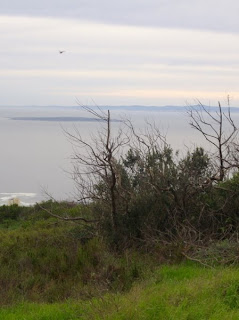
After a way we got a great view back to Lion's Head (we passed the turn-off that would take us up the peak via the back route). We could also see down to Robben Island in the Atlantic.


(Photos by Michele)
Next came the kramat on the ridge of the hill - we had a quick peak inside.


(Photo by Michele) (Photos by Helen)
From here we continued our walk along the spine of the hill. We were on the Atlantic side now, and could see down to Fresnaye, Sea Point and Mouille Point, with the West Coast beyond.


(Photos by Michele)
Along the path we saw lots of Oxalis as well a strange prickly strawberry-like plant that I haven't been able to identify. Can any of you help with its name?


(Photos by Michele)
We came to the main Signal Hill parking and picnic area. Vendors were selling paintings, and ice-cream cones. We sat at the observation deck and ate our naartjies, and gazing at the view.


(Photos by Michele) (Photos by Helen)
Then we meandered back along the same route.


(Photos by Helen)
.


No comments:
Post a Comment