 Date:1 February 2009
Location: on the mountains above Kalk Bay, in the eastern part of the Silvermine Reserve
Walkers: Michele, Dorothy, Jenny, Iain, Helen and Tarryn
The Old Mule Path at Ou Kraal off Boyes Drive is the easiest way to get up into the mountains above Kalk Bay and St James on the False Bay coast. We set off on a hot and sunny summer's morning.
The well-used path climbs very gently up the slope, through thick fynbos.


(Photos by Michele)
We stopped to admire the view of the villages of St James and Kalk Bay below us, and Fish Hoek and Simonstown across the bay.


(Photos by Helen)
Once on top of Ou Kraal we couldn't see any sign of civilization below. It was just sky, sea, mountain and fynbos.

(Photo by Michele)
We then started the second climb, up towards Spes Bona valley between Kalk Bay Mountain on the right and Ridge Peak on the left.

(Photo by Michele)
Sun hats were essential protection as the morning heated up.


(Photos by Helen)
We were amazed at the number of flowers to be seen on the mountain at this time of year.


(Photos by Michele and Helen)
Once we got up into Spes Bona valley proper we followed the path into an area of indigenous Afro-montaine forest. The trees here are mainly yellowwood and milkwood. A wooden board-walk has been constructed through the forest to protect this delicate environment.


(Photo by Helen) (Photo by Michele)
It was delightfully cool and shady in the forest.


(Photo by Helen) (Photo by Michele)
At the edge of the forest we stopped for a bit next to a cliff face that is a waterfall for most of the year, and even in dry midsummer was damp and mossy. Iain spotted a red Disa flower against the cliff.

(Photo by Michele)
Back on the path we headed out of the head of the valley.

(Photo by Michele)
The view back to False Bay was framed by the rocky peaks.

(Photo by Michele)
The path then took us along the plateau.

(Photo by Michele)
The hills above Glencairn and beyond could be seen ahead, and Long Beach and Chapman's Peak in the distance off to the right.


(Photos by Helen)
There were also many flowers to admire up here.


(Photos by Michele and Helen)
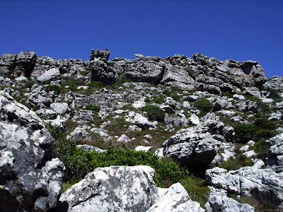
We walked down into the Amphitheatre. It is not hard to believe there are over 60 caves in these mountains. There are rocky outcrops in every direction.


(Photos by Helen)
And next we began our descent into Echo valley.

(Photo by Helen)
We passed through another indigenous forest (known locally as Kroon se Bos or Amazon Forest).


(Photos by Michele) (Photo by Helen)
Back into the sun we continued to head down, back towards Kalk Bay.


(Photos by Michele)
It was such a perfectly fine day that Hangklip on the far side of False Bay was clearly visible.

(Photos by Michele)
We rejoined the Old Mule Path and headed down. As we rounded the bend Muizenberg became visible, and the long stretch beach along False Bay towards the Helderberg.

(Photo by Michele)
It wasn't long until we were back down on Boyes Drive. This circular walk was about 7km long.


(Photo by Michele) (Photos by Helen)


1 comment:
One of my favourite walks and not so crowded like some other walks.
Post a Comment