 Date:
Date: 12 February 2010
Location: Table MountainWalkers: Michele & Helen
****
Route plotted here ****
For this walk we left our car at the Kloof Corner parking area, on the last sharp turn on Table Mountain Rd, before the Lower Cable Station. From here we got a good view of the hairpin bend on the lower stretch of the road below us. Above us we could see the the rocky cliff face of Kloof Corner. Instead of going up here like we've done before (see
here and
here) we walked along the road towards the Lower Cable Station. Although it wasn't windy, the cloud was looming above and touching the top of the mountain.


We took the path that starts behind the parking area for buses just before the Lower Cable Station, signposted 'Table Mountain'. It's a steady climb straight up, mostly on stone steps. It's a well-used path.


The route runs directly under the aerial cableway. The cable cars passed overhead at regular intervals, one up one down.


It was really unusual to see the cableway run in cloudy weather. It has to stop operating when the wind blows, but this afternoon the wind was light, so I guess it could carry on running despite the cloud cover. We guessed that they were mostly bringing people down - by the number of cars still parked around the Lower Station they must have ferried many, many tourists up the mountain earlier in the day. We found it very peculiar to see the cables and cable cars vanish into the cloud!


Devil's Peak was looking very pretty on our left. Look at that gorgeous cloud! Lion's Head and Signal Hil, to our right, were largely cloud-free.


Before long the Lower Station looked far below us and the cliff face we were heading towards got closer and closer. I enjoyed the climb... it got the heart rate up pretty quickly.


At the rock face we met the contour path.

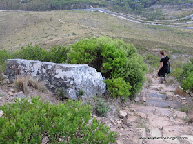
We decided to continue up. Once above the contour path our route continued to the right, up and over rocky boulders.


This is the India-Venster trail up Table Mountain. A sign warned about the dangers of this route. The dangers are real... several people have lost their lives on this section of the mountain in the last couple of years, mostly from losing their way and/or footing on the exposed sections and falling to their death. We were very careful to stick to the path! I have a fear of heights so have no wish to tackle the section that requires rock scrambling and climbing skills. According to my map and the
research I'd done one can walk up the gully to the left of Venster Buttress and (maybe) get to 'The Venster' before reaching the very dangerous part. So that was our plan.

As we climbed the views were pretty spectacular.


The walk up the gully was steep but not difficult. It was fun and exhilarating to tackle a new route!


While I was lagging behind admiring the wonderful vista below, Michele spotted a small snake (black and yellow with a red stripe). Unfortunately it slithered away before I could take a pic. But I didn't miss the cable cars that continued to pass us, now on our left.


We got about three-quarters of the way up the gully when we decided to turn back. It was getting late and a bit chilly and the cloud was moving a little lower. Although it was disappointing not to get as far as we'd hoped, we knew we were doing the right thing. One has got to be sensible and not take any risks on the mountain - it is so easy to get into trouble.

So then it was down-down-down again...


... and back to the contour path. We turned left, heading to Kloof Corner.


Once we got there we peeked around the corner to the Twelve Apostles. The cloud was down on the peaks but the low rays of sun were lighting up the lower green slopes from the side. It looked quite otherworldly.

From Kloof Corner we could see down to our car parked on the bend and the steep path zig-zagging down the hill to take us there. It was a quick and straightforward descent.

The sky was very lovely and dramatic as the sun rays shone down through the clouds. The end of a lovely day and a very enjoyable walk.
 (Photos by Helen)
.


